Menu
Create
Random
Create Account
Login
0
0
0
Language
Deutsch
Español
Français
Italiano
Nederlands
Polski
Português
Suomi
More...
Search...
Featured Quizzes
All Featured Quizzes
New and Reset
Random
Top Today
Geography
History
User Quizzes
Most Recent
All User-Created
Tags
Highest Rated
Most Taken
Nominated Quizzes
Recent Spotlights
Create Quiz
Create / Edit Quiz
New Text Quiz
New Picture Quiz
New Click Quiz
New Click Map Quiz
New Multiple Choice
New Tile Select
SVG Guide
Data and Charts
JetPunk Charts
Recent Charts
Create Chart
Info Pages
Country Population
Interesting Facts
Interesting Quotes
Blogs
Official Blog
User Blogs
Recent User Blogs
Blogs by Tag
Create Blog
Badges and Games
Badges
Word Search
Minigames
Social
Reddit
Discord
Twitter
Instagram
About JetPunk
About Us
Contact Us
JetPunk Premium
Change Log
Terms of Service
Planting Trees
JetPunk Shop
Dark Mode
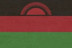
All Districts (SLS) of Malawi on a Map
Can you name all of the second level subdivisions of Malawi on a map?
This is my first SVG quiz ever, so criticisms are welcome, but go easy on me lol.
Quiz by
EytanMelech
Profile
Quizzes
Subscribed
Subscribe?
Rate:
Nominate
Nominated
Spotlight
+ Playlist
Last updated: June 2, 2021
You have not attempted this quiz yet.
More quiz info >>
First submitted
June 2, 2021
Times taken
16
Average score
51.7%
Report this quiz
Report
Quiz and answer stats >>
Friends stats >>
Start Quiz
5:00
Give Up?
Enter answer here
0
/ 29 guessed
Time Used
00:00
Best Time
00:00
The quiz is paused. You have
remaining.
Resume
Scoring
You scored
/
=
%
This beats or equals
% of test takers
also scored 100%
The average score is
Your high score is
Your fastest time is
more stats >>
friends stats >>
Keep scrolling down for answers and more stats ...
Retake Quiz
Share Result
Central Region
Dowa
Dedza
Kasungu
Lilongwe
Mchinji
Nkhotakota
Ntcheu
Ntchisi
Salima
Northern Region
Chitipa
Karonga
Likoma
Mzimba
Nkhata Bay
Rumphi
Southern Region
Balaka
Blantyre
Chikwawa
Chiradzulu
Machinga
Mangochi
Mulanje
Mwanza
Nsanje
Thyolo
Phalombe
Zomba
Neno
4 Comments
Show comments >
JWatson24
+4
Level 71
Jun 3, 2021
This is impressive for a first SVG! The one thing is I think that the strokes might not be consistent throughout the whole thing (especially along the borders)? But I might be wrong. Either way, nice job!
EytanMelech
+2
Level 67
Jun 3, 2021
What I did in this SVG was I apparently filled the SVG with the bucket tool instead of using fill and stroke, so there are two paths per district?
JWatson24
+3
Level 71
Jun 3, 2021
Oh, that's weird. I don't think I've ever used the bucket tool, but then again I've never made this style of quiz. :/
Whatever it is, it looks fine overall. The problem with the stroke isn't
that
noticeable.
NV1
+3
Level 51
Jun 7, 2021
Belated congrats on the first SVG! #FirstMap
Add comment
New and Popular
all
de
en
es
fi
fr
it
nl
pl
pt
Countries of the World Quiz
US States Quiz
Random Capital to Country
Countries of Europe Quiz
Fifty US States in One Minute
US States by Borders in 30 Seconds
Countries by First Two Letters in 90 Seconds
12 Months in 15 Seconds
Countries that Start with T
Digits of Pi
Island Countries Quiz
Countries that Start with U
Elements of the Periodic Table Quiz
Countries of Asia Quiz
Countries that Start with A
Random
Top Today
Save Your Progress
Create Account
Second Level Subdivisions
Quiz series by EytanMelech
All Departments (SLS) of Cameroon on a Map
All Districts/Alwiya (SLS) of Jordan on a Map
...
Neighborhoods of Philadelphia Map Quiz
Tous les Départements (SDN) de Cameroun sur une Carte
Prev
View All
Next
Whatever it is, it looks fine overall. The problem with the stroke isn't that noticeable.