Featured Quizzes
User Quizzes
Create Quiz
Data and Charts
Badges and Games
About JetPunk
JetPunk Shop
Dark Mode
Random Mode
Keyboard shortcut: Command/Ctrl + Shift + R
Tallest Countries North to South
Name the countries that have the longest north/south spans.
Not including Greenland
Continuous spans on the same land mass, not including exclaves
Also see widest countries
Rate:
Featured Quiz
Last updated: December 10, 2019
You have not attempted this quiz yet.
More quiz info >>
| First submitted | August 8, 2015 |
| Times taken | 94,042 |
| Average score | 75.0% |
| Rating | 4.81 |
4:00
Enter answer here
0
/ 20 guessed
Time Used
00:00
Best Time
00:00
The quiz is paused. You have remaining.
Scoring
You scored / = %
This beats or equals
% of test takers
also scored 100%
The average score is
Your high score is
Your fastest time is
Keep scrolling down for answers and more stats ...
|
|
|
New and Popular
Save Your Progress


Copyright H Brothers Inc, 2008–2024
Contact Us | Go To Top | View Mobile Site
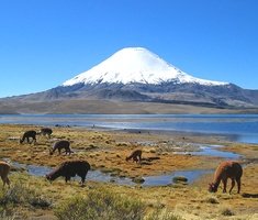
Brazil 4°27'N to 33°45'S equals 38°12' lines of latitude.
Chile 17°30'S to 53°54'S equals 36°24' lines of latitude.
Much of the southern tip of Chile you see on a world map is islands, extending to about 55°59'S, which would give Chile the very slight win in a lines of latitude battle between the two, at 19' of latitude (19 nautical miles).
If we're going non-contiguous, Russia, the USA, Canada, and potentially even China beat them both.
You can compare their lengths. Kazakhstan is just barley shorter than Thailand.
I am an idiot.
Me: impossible